Trail Mountain bike Molina de Segura - Trasvase - Photo
 reyes
reyes

User

© OpenStreetMap contributors
Length
Length
29 km
Max alt
Max alt
292 m
Uphill gradient
Uphill gradient
484 m
Km-Effort
Km-Effort  
35 km
Min alt
Min alt
108 m
Downhill gradient
Downhill gradient
485 m
Boucle
Boucle
No
Creation date :
2014-12-10 00:00:00.0
Updated on :
2014-12-10 00:00:00.0

(0 Reviews)

Mountain bike
Mountain bike
--
Difficulty : Unknown

Scan this QR Code to open this trail in the SityTrail application

FREE GPS app for hiking

Logo SityTrail SityTrail

IGN / Geographical institutes

Download SityTrail from the App Store Download SityTrail from Google Play

Logo SityTrail SityTrail World

The world is yours!

Download SityTrail from the App Store Download SityTrail from Google Play Download SityTrail on Huawei AppGallery

About

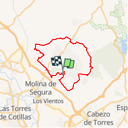
Trail Mountain bike of 29 km to be discovered at Region of Murcia, Region of Murcia, Molina de Segura. This trail is proposed by reyes.

Elevation profile

Positioning

Country:
Spain
Region :
Region of Murcia
Department/Province :
Region of Murcia
Municipality :
Molina de Segura
Location:
Unknown
Start:(UTM)
659974 ; 4215389 (30S) N.

Trails nearby

Trail On foot Molina de Segura - PR-MU 73 Sierra del Águila - Photo
On foot
PRO

On foot

Easy
Molina de Segura, Region of Murcia, Region of Murcia, Spain
14.4 km | 19 km-effort
4h 19min
No


Close
My subscriptions